Tortilla Flat
By this time it was after 1:30pm and it was actually quite hot, so I put on shorts and a tank top. At our next locale a guy walking by said “a tank top and shorts?” as if to say “are you nuts?!” We saw people wearing jackets at the ghost town and it had to be at least 25c or more at that point. We thought they were nuts.
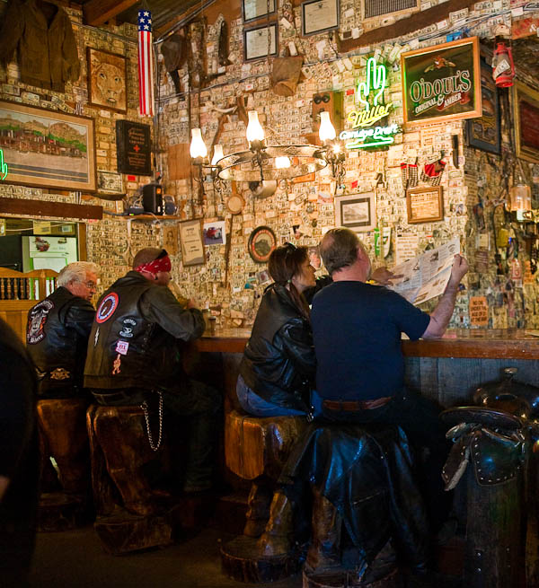
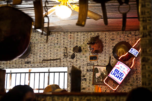
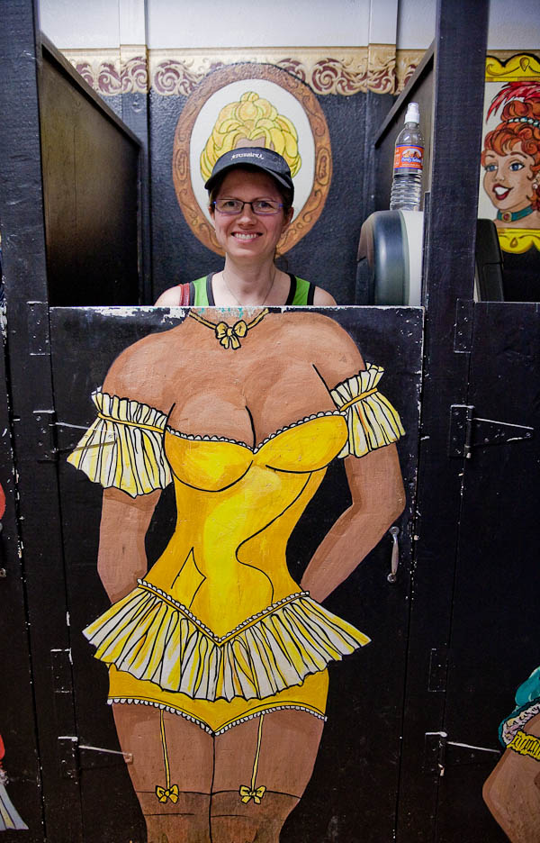
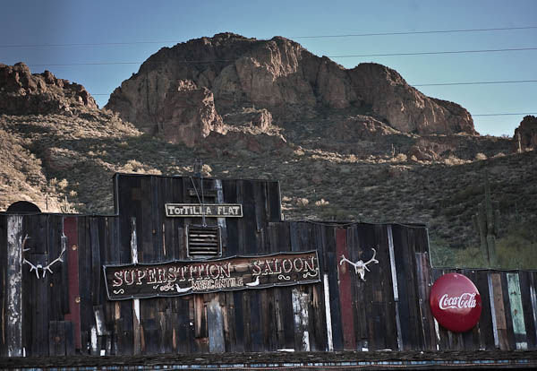
Tortilla Flat is a mandatory stop for lunch apparently, so we did just that. The town has also burned to the ground twice and been rebuilt and all that’s really there is a gift shop, saloon/restaurant, and candy/ice cream parlor. Inside the restaurant, you can sidle up to the bar and have a cold one, whilst sitting on a saddle which Rob took the opportunity to experience while waiting for me to return from the “restroom”. (sidebar: it’s not the washroom or bathroom here in the US, if you ask for that you get funny looks) Or get a booth and sit and ponder how much money the walls are worth. There is money from every imaginable country, in every sort of denomination stapled onto the walls. They’re completely covered! In some places, it’s even layered. I wonder, how do you insure that?
After lunch we chose to try the also famous prickly pear cactus ice cream. We don’t generally eat dairy foods, but we figured we had to try it just to say we did (when in Rome). It wasn’t that great and we didn’t feel so hot after. So needless to say we won’t likely be following that rule again in future. Just because it’s a “must do” does not mean you have to do it. My advice, trust your gut instinct.
No Phone Service in Tortilla Flat
A small one room school house is also left standing from the fires. It is now a small museum with facts on the town, which has an actual population of 6 people. They cannot get phone service in this town. They’ve tried to get it run but the phone companies wanted 10’s of 1000’s of dollars to hook it up and that cost couldn’t be justified I guess. The Tortilla Flat museum explains the history of phone service request over the years, the latest being a quote of $180,000 just to run the lines. No cell service either. Internet? Bah! Good luck with that one! Nope, it’s as isolated as they get. Even at the top of Machu Picchu in Peru there was cell service, but not in Tortilla Flat, AZ.
Something else we learned at the museum was that the town was up for sale in 1998 and bought by two couples for a sum less than $500,000. Rob seems to recall that it was in the $350,000 range, but can’t quite remember the exact sum. For that price HE would have bought it.
I took a few photos across the road, and we were off again to continue along the Trail. A few miles outside Tortilla Flat the pavement ends and it’s graded gravel for 22 miles. We only went a few hundred feet when Rob turned around and said “I can’t do this with you” as I was paranoid about sliding off the dirt road into a canyon or crevice. I convinced him to go back and do it anyway and I’ll shut up.
Rob here: I’m a very patient guy and able to handle just about any sort of stressors, but Dar was quite literally freaking out!. There was no way I’d be able to put up with 2 hours of what she was going through in the first mile. I had no choice but to turn around. When we got back to the pavement, she begged me to go back and that she’d close her eyes and keep her mouth shut. She even tilted her seat back and put her hat over her eyes.
Stopping at a few viewpoints we had a some interesting sights along the way. One was, without a doubt, the most disgusting thing I’ve ever seen in an outhouse. You know those ones in parks with the real toilet seat, concrete floor but no running water? Well someone had gone – shall we say #2 – beside the toilet, on the wall and on the floor! Rob had to go in and see it for himself as he kept seeing people go in, and turn around and come right back out and go to the other toilet. He agreed, it was gross. Who does that???!! Better yet – in what position did they put themselves to get it there? My guess is, it was a bet or a dare.
That viewpoint was the top of Fish Creek Hill. We learned about the history of the road we were about to experience on the way to the bottom of the valley, dropping 1500 feet in a short distance, sometimes at a 10% grade. Apparently at the turn of the century a speed limit of 10 miles an hour was imposed. Prior to that, the uphill portion of the hill was used as a race track where drivers would challenge each other to reach the top in the shortest amount of time. Due to the number of accidents on the road and vehicles going over the edge, the new speed limit was created. Dare devils have long since loved this road, white knuckle passengers and drivers – do not attempt this!
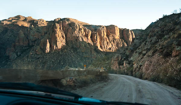
The road is narrow with many switch backs and even a few one lane bridges where passing traffic must alternate to cross. There isn’t much for guard rails and it’s likely they wouldn’t make much difference anyway. This road has been described as: harrowing, treacherous, and yet exhilarating and picturesque. Although the drivers cannot see the scenery because it is way too dangerous to take their eyes off the road even for just a second. A car coming the other way, taking a turn too fast, or being too far into the middle of the road – and it’s easy to see why some end up going over into the abyss.
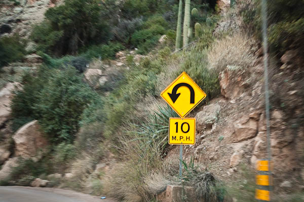
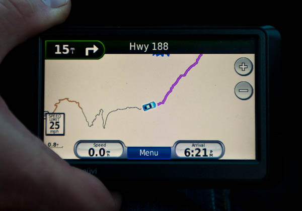
After surviving Fish Creek Hill on the east side of Tortilla Flat and talking about it the rest of that night and the next day, we found this little video about another man’s experience. He was filming his drive along Fish Creek Hill as he looked for the point in which a car went over the edge. Funny stuff AND shows how extreme this road is.
Driving Fish Creek Hill
Part way along this harrowing road Rob thought maybe we could use some more gas, so we stopped at a campground by a lake that had gas on the sign. Turned out it was just for boats but at that point we had a decision to make. We’d only gone about 8 miles in a hour and it was now almost 5pm. It would be dark in another hour and we still have 14 miles of gravel road ahead of us (NO lights on the road). We decided to push on so we could get to Roosevelt Dam before dark.
The dam was built from 1906-1911 and was a big reason Route 88 Apache Trail was developed and the speed limit imposed. By the time we got there, it was mostly dark and pretty cold – so I did a Chevy Chase National Lampoon version of it and got out – looked at it, and got back in the car. We couldn’t really even see anything from the roadside pull out where we stopped anyway.
But finally, we were back on pavement! Hallelujah!
I’ve driven dirt roads in my time, but 22 miles is 35 km and it took us almost exactly 2 hours to complete it, with a couple short stops. The maps and GPS all said it would take 1.5 hours and I didn’t believe it until we’d done it ourselves. So I survived the road, and Rob survived me on the road. I can tell you our necks were both hurting and I’d been vibrated enough to make my stomach quite nauseous. I was quite glad to have the next 80 or so miles back to Phoenix on good old hardtop pavement!
Rob’s Here: What Dar isn’t saying is that we actually argued on multiple occasions about the road back. Going back over that 22 miles of gravel, turns, and vibration vs 80 miles of pavement through Globe. Our discussions revolved mostly around the time it would take, the safety, the comfort and the mileage. Most of the Fish Creek Hill road was 10 to 20 mph, completely unlit and very narrow with hair pin turns. On our way back, we’d be on the outside edge of the road which drops off into the abyss. Both would take the same amount of time (22 miles of shit road at 15 mph vs 80 miles of road at 65 to 75 mph). As day turned to night and our gas tank lowered, I opted for the pavement, lights and nearest gas station.
Dinner at a great Thai restaurant I found in Tempe at 8pm and we headed home to the RV park completely exhausted.
Hence my comment at the beginning of this post. We thought we’d do the trail two days in a row and go back tomorrow for the paddle wheel boat tour on Canyon Lake, and I’d do a horseback ride while Rob maybe did a short 1 hour, or so, hike. We were so done in, we just wanted to sleep in and do nothing Sunday. So rest assured we will go back to do those things – just not tomorrow.
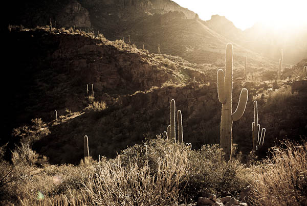
Images in this post are available for purchase on the Her View Photography online gallery at Zenfolio.com.
Note: This post is 3 pages long. Click here to begin reading about our trip on the Apache Trail Route 88
You may think that I dont look happy in that photo, but in fact, that’s my patented “Smile #1”
He means the one of him in the saloon doorway
That “Kid Kollodian” sure has some special talents doesn’t he? Great pictures indeed!! It’s obvious to me that he has much passion for his work. Kudos to you “Kid”!
Hi Rob and Darlene– Enjoyed your blog and your experience driving the Apache Trail to Roosevelt Dam. We knew nothing about the Apache trail when we left the Lost Dutchman State Park on Feb.14 2010 and headed for what we thought would be a nice scenic trip to the dam. we were driving a 36.5 Fleetwood Bounder. What a shock when we came off the pavement and the road narrowed. No turning back Fish Creek hill was unbelievable–Scary-Ben
@Ben… OMG…. I can’t believe you did that. Fish creek hill WOULD be unbelievably scary! Holy shit!
FYI for all Young Snowbirds readers: Road Trip calendars for 2011 are now available on my site. I had so many images and requests to have them that I have created a calendar of some of my favorites from the road. You can see all the images in the calendar and order one on my photography blog at: http://www.herviewphotography.com/2010/09/30/road-trip-2011-calendars.html